SwaPrep presents · A chapter in History
The Indus Valley Civilization
Four thousand years before us, the largest civilization of the Bronze Age built cities we are still learning from.
7 acts · 24 scenes · scroll to play↓
I
The Lost World
The discovery1921 CE
A civilization found brick by brick
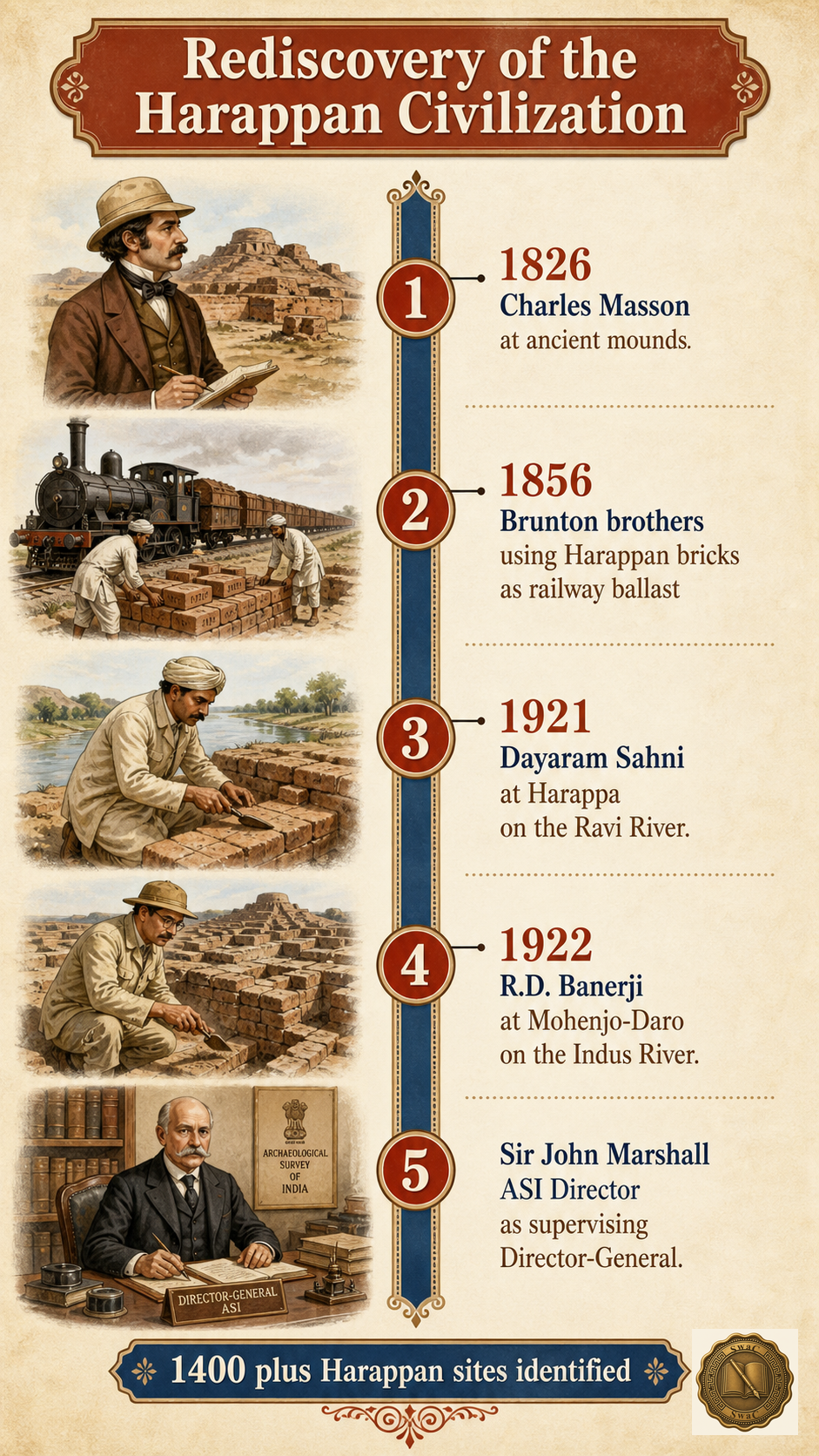
In 1826, a British deserter named Charles Masson noticed strange mounds at Harappa and mistook them for Buddhist ruins. Thirty years later, railway engineers crushed Harappan bricks into ballast for the Lahore–Karachi line, unknowingly destroying part of the site. Only in 1921 did Dayaram Sahni begin the first systematic excavation at Harappa, and in 1922 R.D. Banerji uncovered Mohenjo-Daro — the 'Mound of the Dead' — on the banks of the Indus. Their director, Sir John Marshall, realised they had found a civilization the world had completely forgotten.
Marks-winning facts · recall first
- Both digs ran under Sir John Marshall, ASI Director-General
The scale
Larger than Mesopotamia and Egypt combined
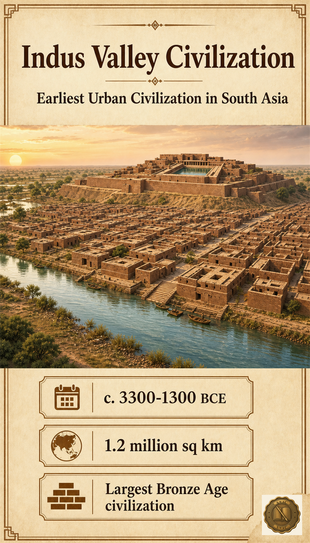
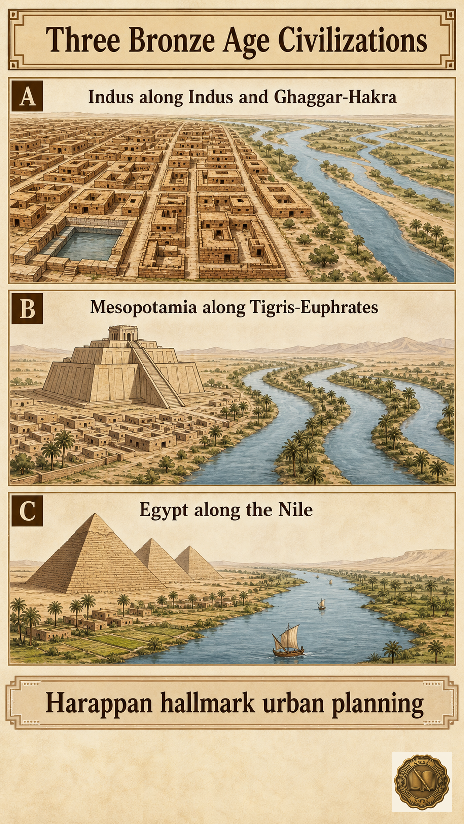
What Marshall's teams had found was the earliest known urban civilization in South Asia — and the largest of all Bronze Age civilizations. At its height it spread across roughly 1.2 million square kilometres of present-day India and Pakistan, along the Indus and the now-vanished Ghaggar-Hakra river systems. Unlike Egypt or Mesopotamia, it built no great temples and no royal tombs; its monuments were planned streets, standard bricks, and trade networks.
Marks-winning facts · recall first
- One of the world's three earliest civilizations, with Mesopotamia and Egypt
II
The Rise
The chronology2600 BCE
Three phases, three thousand years
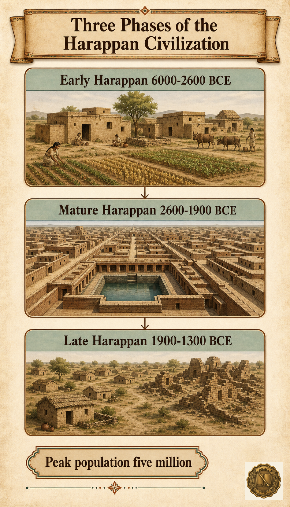
The story unfolds in three phases. In the Early Harappan period (6000–2600 BCE), farming villages like Mehrgarh learned to domesticate animals and grow wheat and barley. Then, around 2600 BCE, came the leap: the Mature Harappan period (2600–1900 BCE) — planned cities, the Great Bath, standardized bricks, covered drains, and trade with Mesopotamia, with a peak population near five million. After 1900 BCE the Late Harappan decline set in: cities emptied, writing and weights vanished, and urban life dissolved back into villages.
Marks-winning facts · recall first
- Exam questions almost always mean the MATURE phase
The frontiers
From the Himalayas to the Deccan
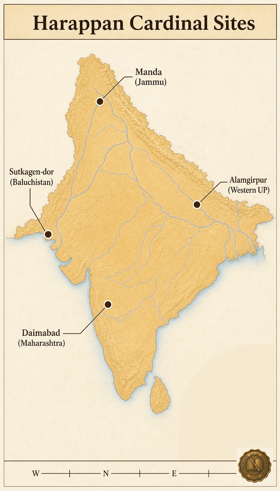
Four sites mark how far this world stretched. Manda in Jammu touched the Himalayan foothills in the north. Daimabad in Maharashtra carried Harappan culture deep into the Deccan Plateau in the south. Alamgirpur in western Uttar Pradesh reached the Ganga-Yamuna doab in the east, and Sutkagen-dor sat on the Makran coast near the Iranian border in the west — most likely a trading outpost facing the sea routes.
Marks-winning facts · recall first
The sites
Sixteen cities, one civilization
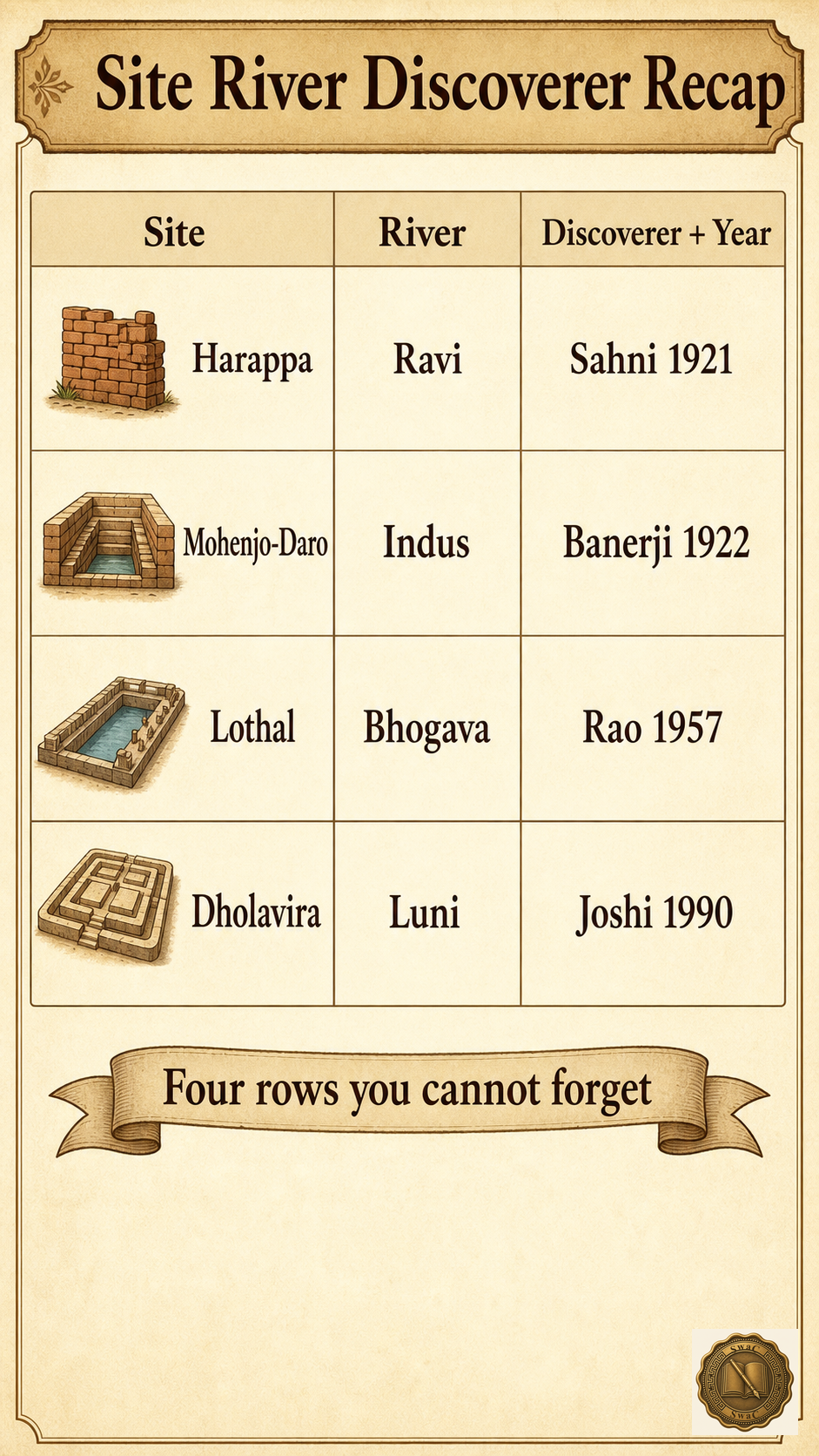
Each excavated city added a piece to the puzzle. Kalibangan in Rajasthan kept fire altars and a ploughed field older than the city itself. Chanhudaro — the only major site with no citadel — ran bead workshops and even left behind an inkpot. Ropar was the first site found in independent India, where a man was buried with his dog. Dholavira in Kutch, the largest site in India and a UNESCO World Heritage Site since 2021, raised a ten-sign wooden signboard — perhaps the world's oldest public notice. And Rakhigarhi in Haryana, larger even than Mohenjo-Daro, is the largest of them all. This table of sites, rivers and discoverers is the single most tested asset in the chapter.
Marks-winning facts · recall first
III
The City Machine
Urban planning
Streets at right angles, bricks in one ratio
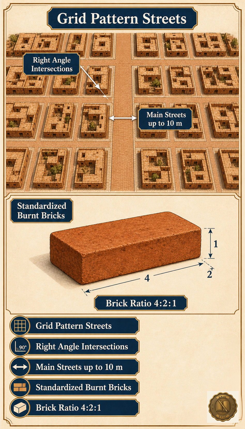
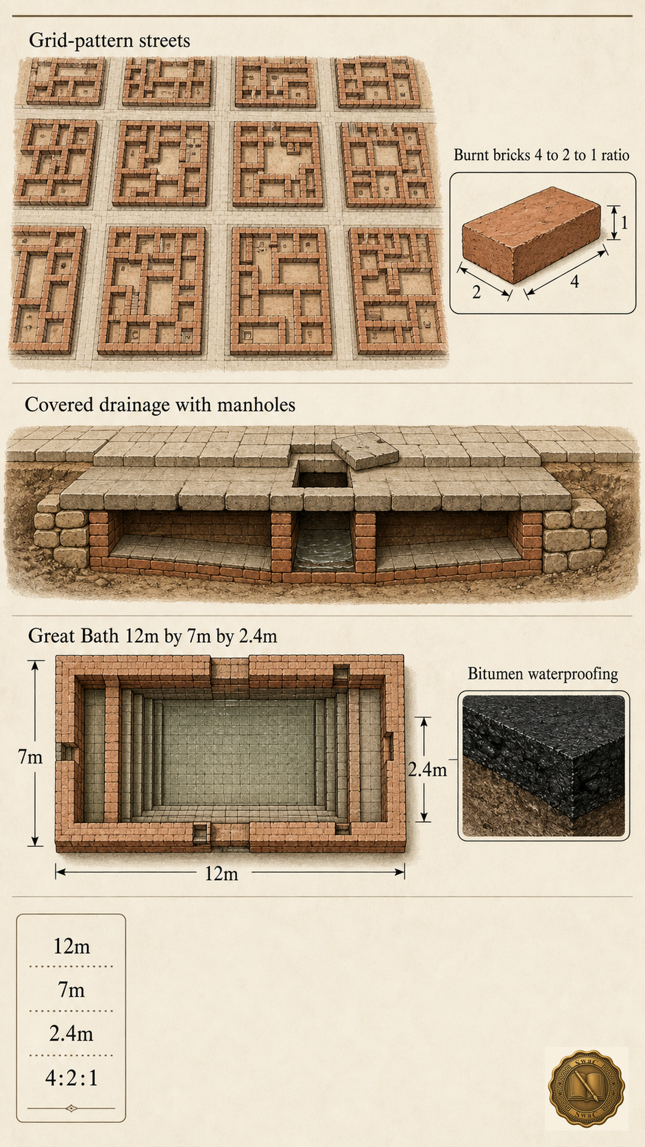
Harappan cities were machines of order. Streets crossed at strict right angles in a grid — something neither Egypt nor Mesopotamia had at the time — with main roads up to ten metres wide. Every city had two zones: a raised, fortified Citadel to the west for administration, and a Lower Town to the east where people lived and worked. And everywhere, from city to city hundreds of kilometres apart, houses were built of burnt bricks in the exact same 4:2:1 ratio — evidence of a planning authority whose word ran across an entire subcontinent.
Marks-winning facts · recall first
- Grid-pattern streets intersecting at right angles
- Chanhudaro is the only major site with NO citadel
Sanitation
The only ancient civilization with covered drains
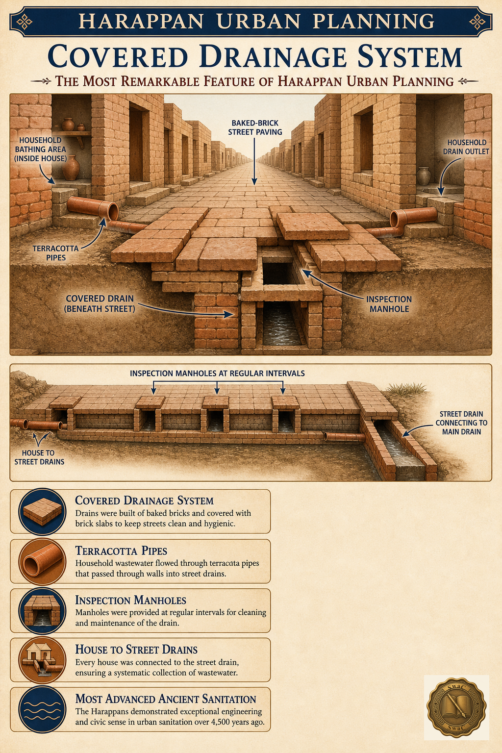
The most remarkable feature of all lay under the streets. Household drains fed into covered street drains through terracotta pipes, which emptied into mains fitted with inspection manholes at regular intervals. No other civilization of the ancient world — not Egypt, not Mesopotamia, not early China — built sanitation infrastructure of this sophistication.
Marks-winning facts · recall first
- Put in order · tap the steps in sequence
Mohenjo-Daro
The Great Bath — where ritual purity began
At the heart of Mohenjo-Daro's citadel sat a pool twelve metres long, seven wide and 2.4 deep, built of tightly fitted burnt bricks sealed with bitumen — natural tar used as waterproofing. Steps led down into the water; a well in an adjacent room filled it, and a covered outlet drained it. Most scholars read it as a ritual bathing facility: the earliest evidence of the purification practices that remain central to Indian culture four thousand years later.
Marks-winning facts · recall first
- Earliest evidence of ritual bathing in South Asia
The economy of order
Granaries of the state, weights of sixteen
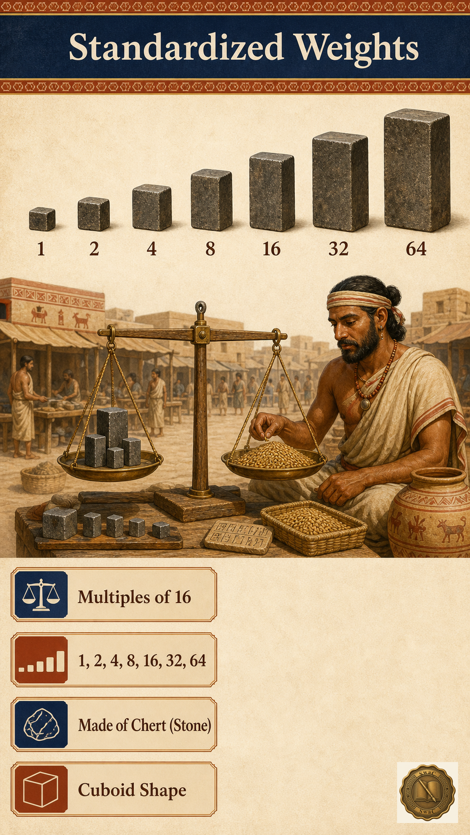
Harappa kept six granaries in a row with air ducts beneath the floors; Mohenjo-Daro's great granary measured nearly 46 metres long. Grain storage on this scale means a managed, centralized economy. Its instrument was a system of cuboid chert weights that doubled in multiples of sixteen — 1, 2, 4, 8, 16, 32, 64 — identical across the whole civilization, almost certainly enforcing trade regulation and taxation.
Marks-winning facts · recall first
IV
The Genius
Agriculture
The first people on Earth to grow cotton
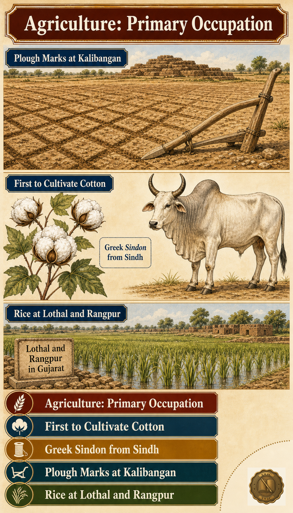
Farming fed everything. The Harappans grew wheat, barley, dates, peas, sesame and mustard — and they became the first civilization in the world to cultivate cotton. The Greeks would later call the fabric 'sindon', after Sindh itself. At Kalibangan, furrow marks preserved in the earth show fields cut by wooden ploughs; at Lothal and Rangpur, husks prove they grew rice.
Marks-winning facts · recall first
Trade
Meluhha: the land Mesopotamia traded with
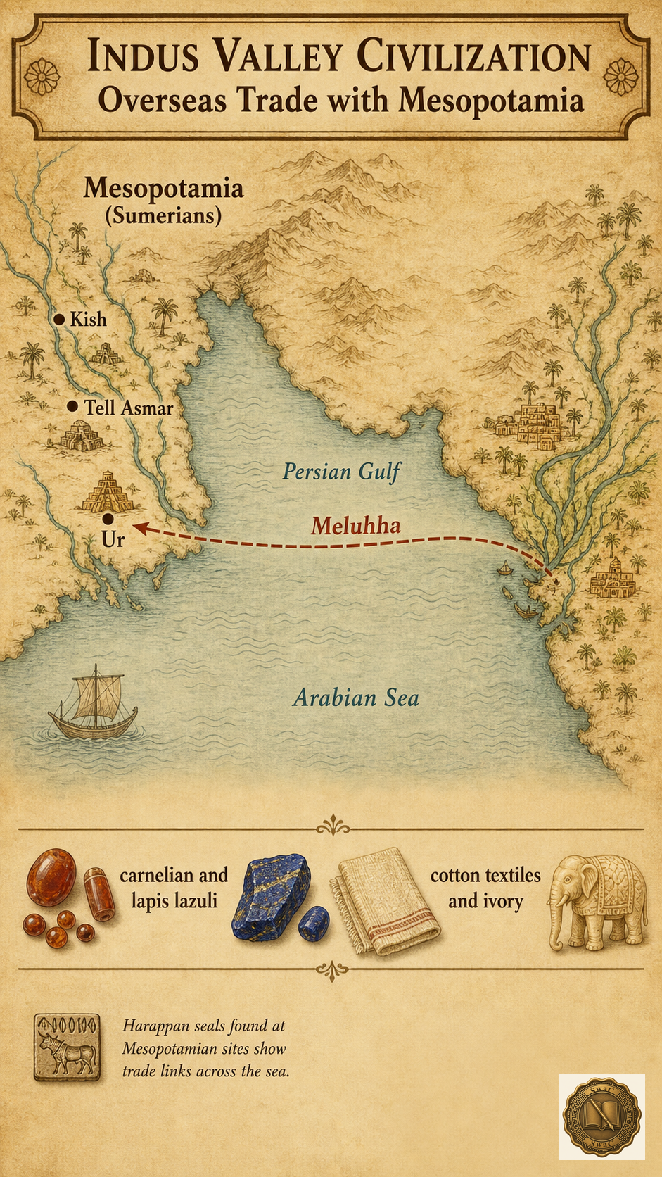
Harappan seals have been dug up at Ur and Kish in Mesopotamia, and Mesopotamian tablets speak of trade with a land called 'Meluhha' — almost certainly the Indus country. Carnelian beads, lapis lazuli, copper, ivory and cotton textiles moved west. The gateway was Lothal in Gujarat, whose brick dockyard — 214 metres by 36 — is the earliest known in the world; a Persian Gulf seal found there seals the case for maritime trade.
Marks-winning facts · recall first
- Mesopotamian texts call the Indus region 'Meluhha'
- Harappan seals found at Ur, Kish, Tell Asmar
The materials
A palette of five materials — and no iron
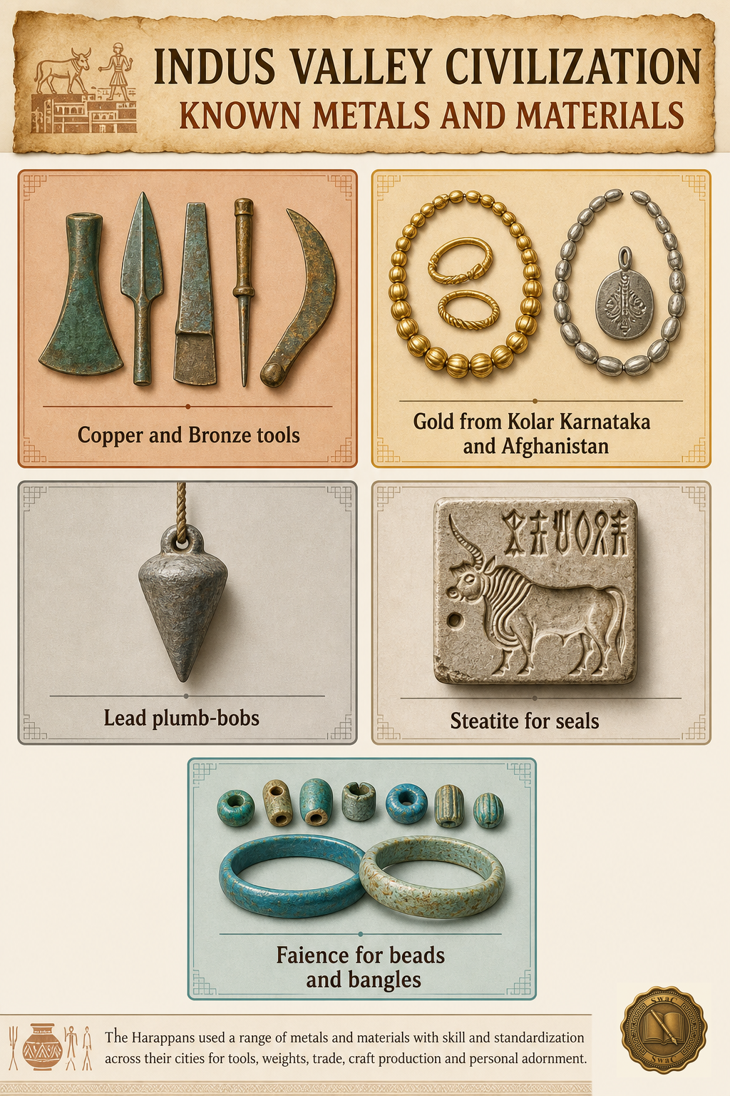
Harappan workshops ran on five signature materials. Copper and bronze — the copper-tin alloy that names the whole age — made the tools, weapons and ornaments. Gold and silver, likely from Kolar in Karnataka and from Afghanistan, became jewellery. Lead hung as plumb-bobs and weights. Steatite, the soft soapstone, was carved into thousands of seals. And faience — artificially glazed ceramic — glittered as beads, bangles and figurines.
Marks-winning facts · recall first
Masterpieces
A dancing girl and a priest-king
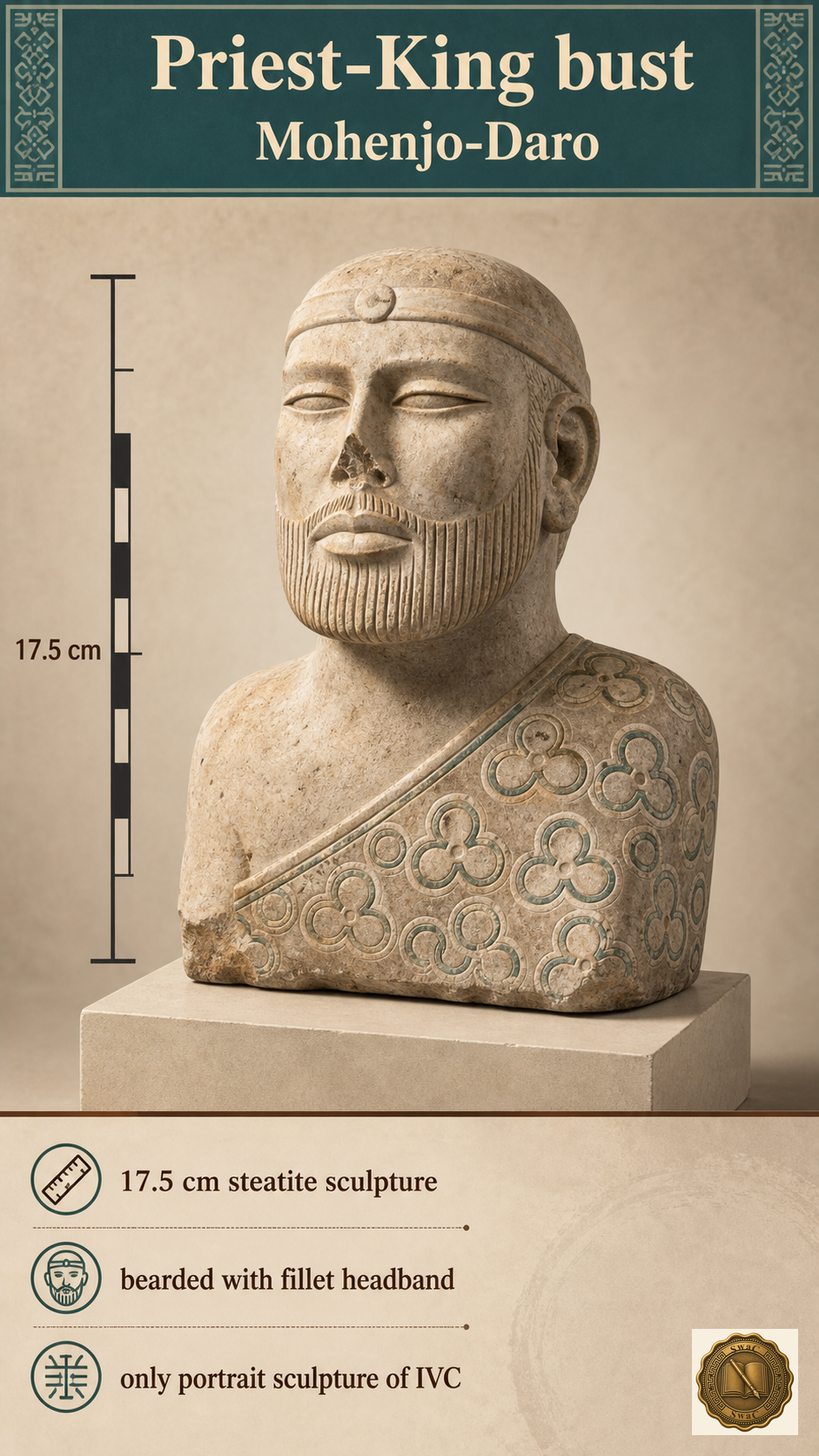
Two small objects carry the civilization's artistic soul. The Bronze Dancing Girl of Mohenjo-Daro — just 10.5 centimetres tall, bangles stacked on her left arm, posture utterly confident — was cast by the lost-wax technique, proof of advanced metallurgy. The Priest-King, a 17.5-centimetre steatite bust of a bearded man in a decorated robe, is the only portrait-like sculpture ever found — perhaps a ruler, perhaps a priest, perhaps both.
Marks-winning facts · recall first
- Both from Mohenjo-Daro
The script
Four hundred signs nobody can read
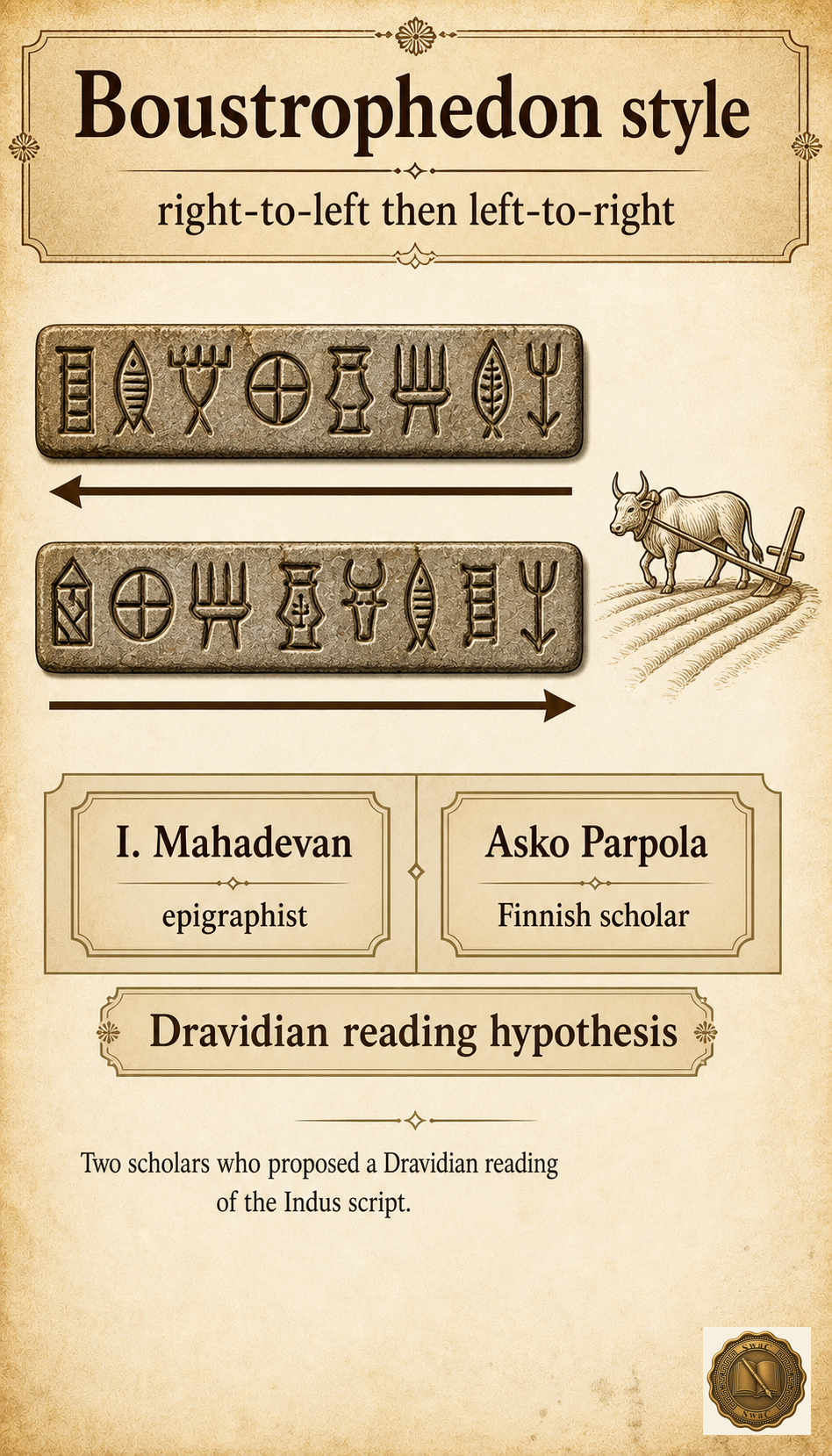
The Harappans wrote — and we cannot read a word of it. Their pictographic script, some 400–500 distinct signs, runs boustrophedon: right-to-left on one line, back left-to-right on the next, like an ox ploughing a field. The longest inscription ever found is only 26 characters. Scholars I. Mahadevan and Asko Parpola have argued the language behind it is Dravidian — but the script remains one of archaeology's great unsolved puzzles.
Marks-winning facts · recall first
The seals
A unicorn on every trader's stamp — and a god in yoga
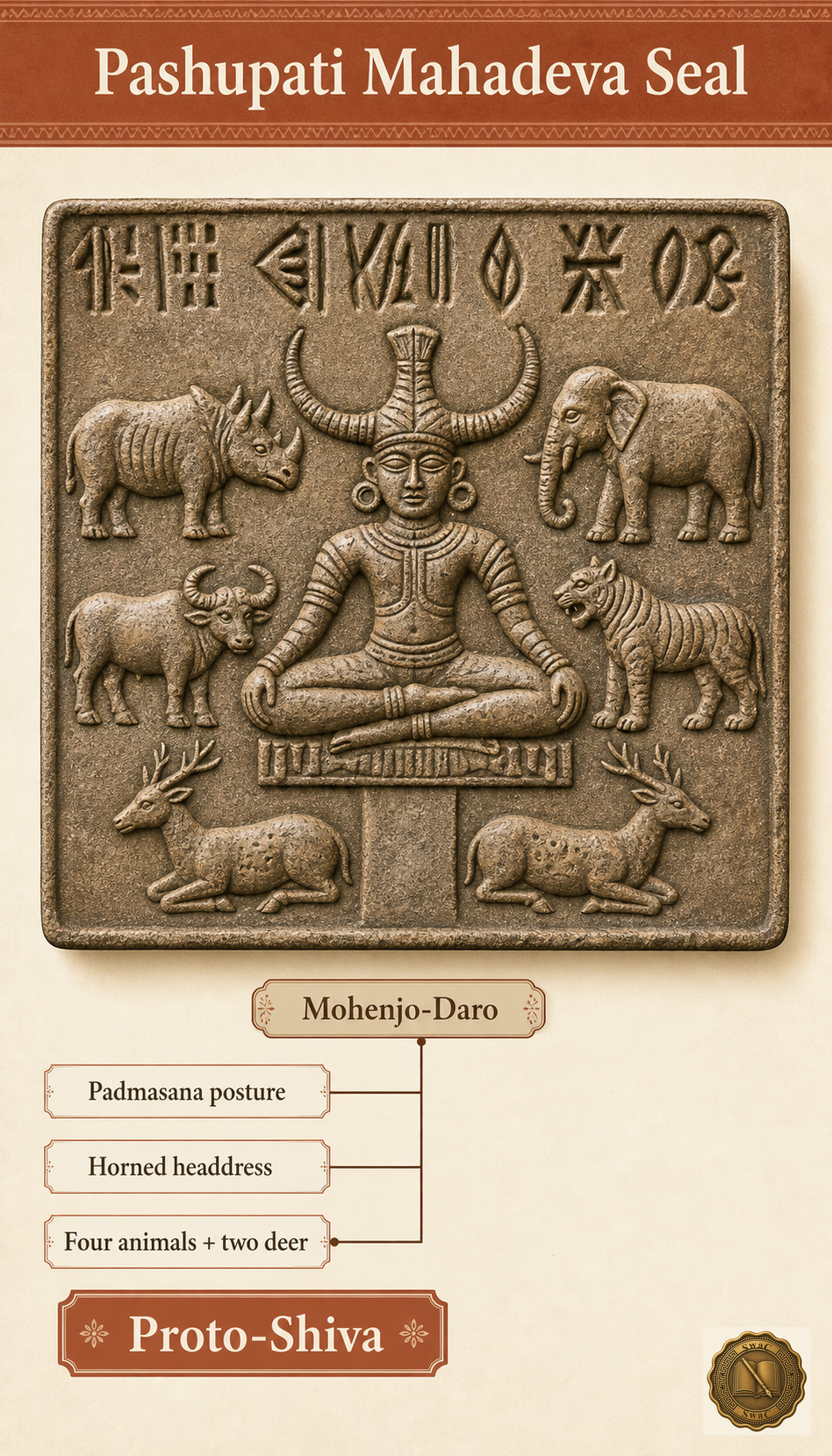
More than 3,500 steatite seals survive, most barely an inch square, used as identity markers, trade tags and amulets. The animal carved most often is the unicorn — a one-horned beast, possibly a bull in profile. But the most famous seal of all shows a horned figure seated cross-legged in padmasana, ringed by an elephant, a tiger, a rhinoceros and a buffalo: the Pashupati seal, read by many as Proto-Shiva, a four-thousand-year-old thread connecting the Indus world to living Hindu tradition.
Marks-winning facts · recall first
V
The People
Religion
A civilization that built no temples
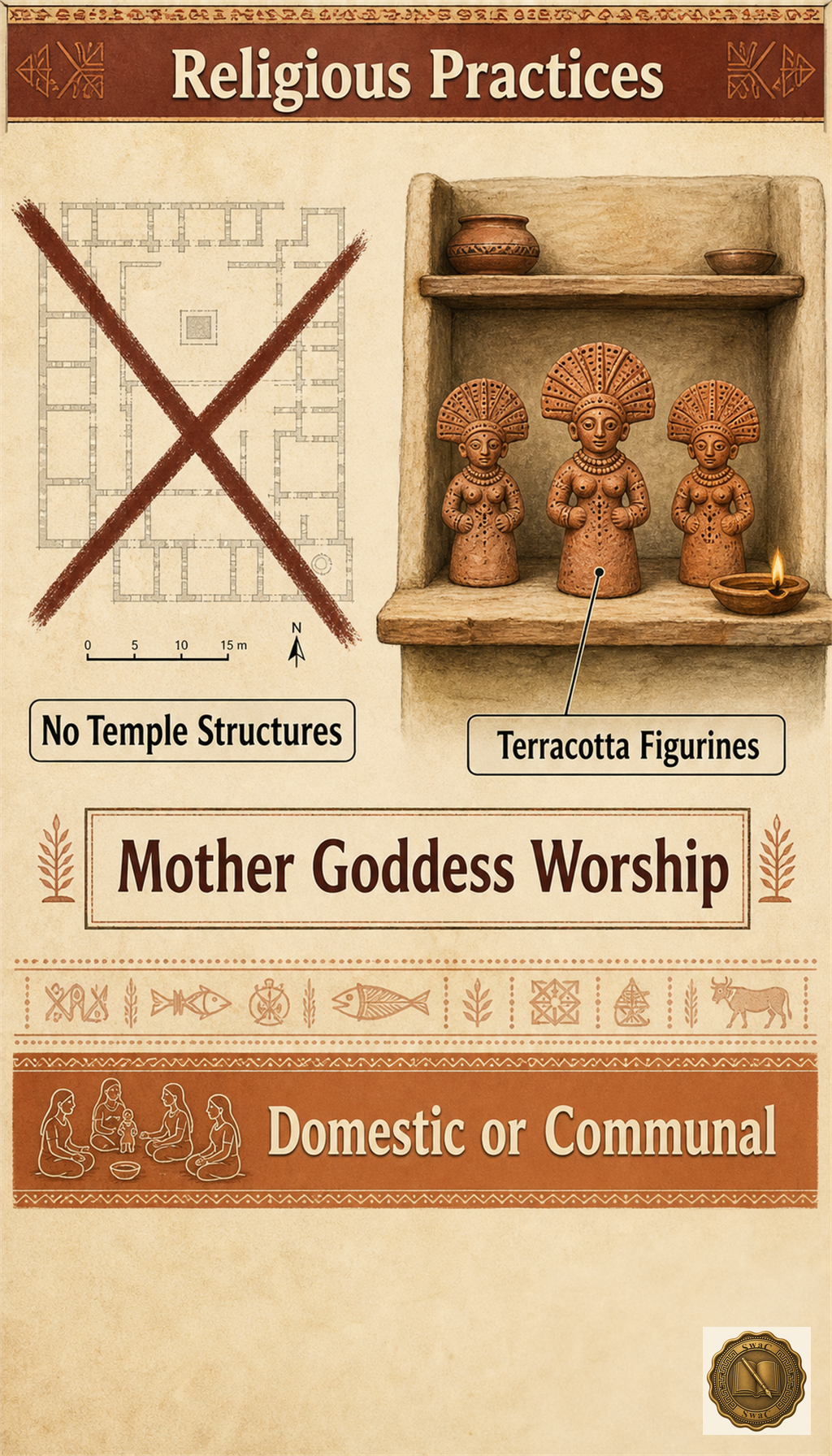
Among all ancient civilizations, this one is unique: not a single temple structure has been found at any Harappan site. Worship lived at home and in nature — terracotta Mother Goddess figurines for fertility, the sacred peepal tree on seals, and fire altars at Kalibangan, the earliest trace of rituals that look almost Vedic.
Marks-winning facts · recall first
Society
No palaces, no kings, no armies
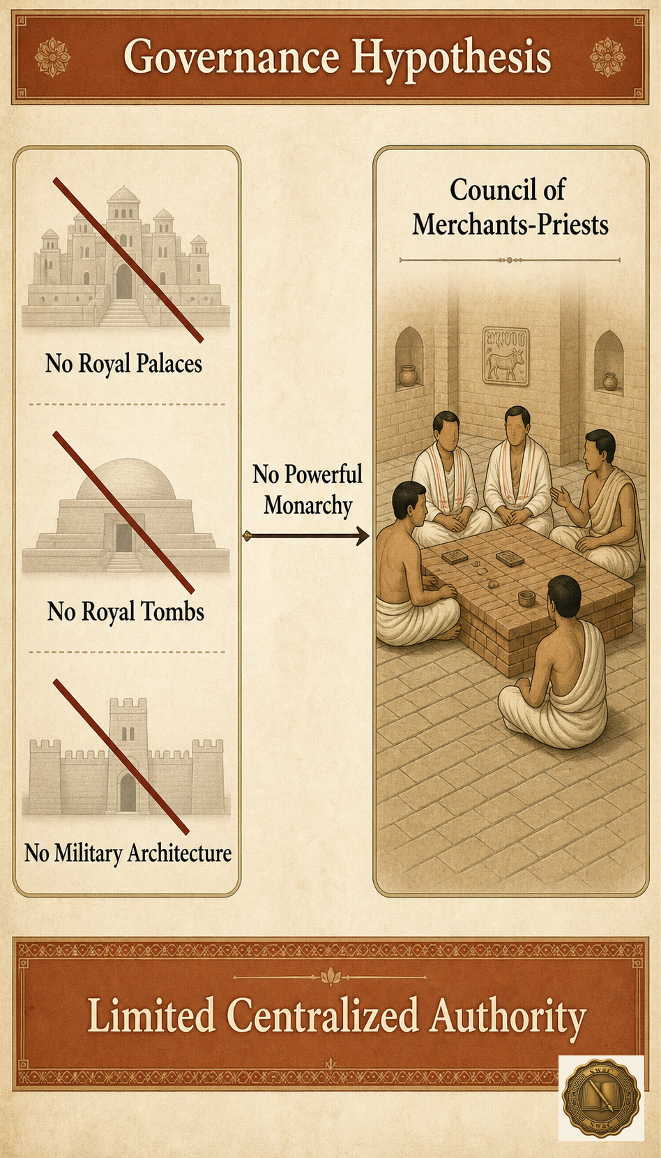
Where Egypt raised pharaohs and Mesopotamia crowned kings, the Indus cities show no grand palaces, no royal tombs, and no monumental military architecture. House sizes in the lower towns are strikingly uniform, suggesting a society more equal than any of its contemporaries. Many scholars believe these cities were run not by a monarch at all, but by councils of merchants or priests — government by standardization rather than by the sword.
Marks-winning facts · recall first
- No evidence of monarchy, palaces, or a standing military
- Put in order · tap the steps in sequence
Burials
Three ways to say goodbye
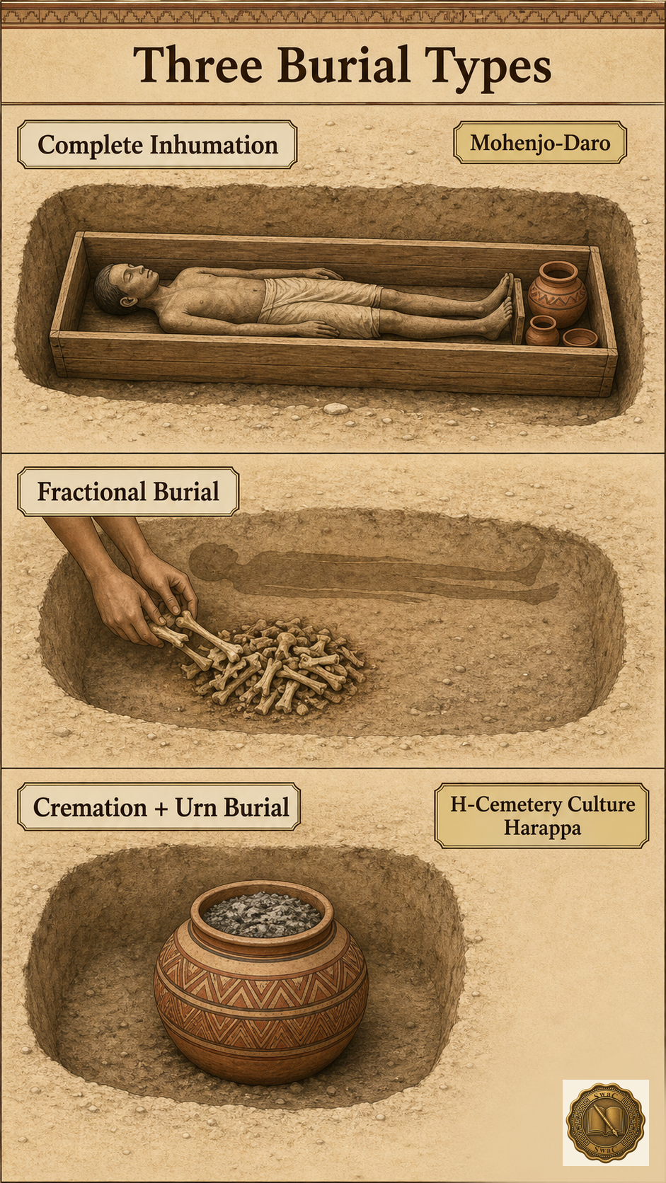
The dead were sent off in three ways: complete inhumation, the body laid out in a wooden coffin — the commonest rite at Mohenjo-Daro; fractional burial, where the body was first exposed to the elements and only the bones interred; and cremation, the ashes placed in painted urns of the late H-Cemetery culture at Harappa. At Lothal, archaeologists found a man and a woman buried together. Grave goods were modest pots and ornaments — never grand tombs. Even in death, this was a society without pharaohs.
Marks-winning facts · recall first
- Double burial (man + woman) found at Lothal
VI
The Fall
The decline1900 BCE
The rivers failed, and the cities let go
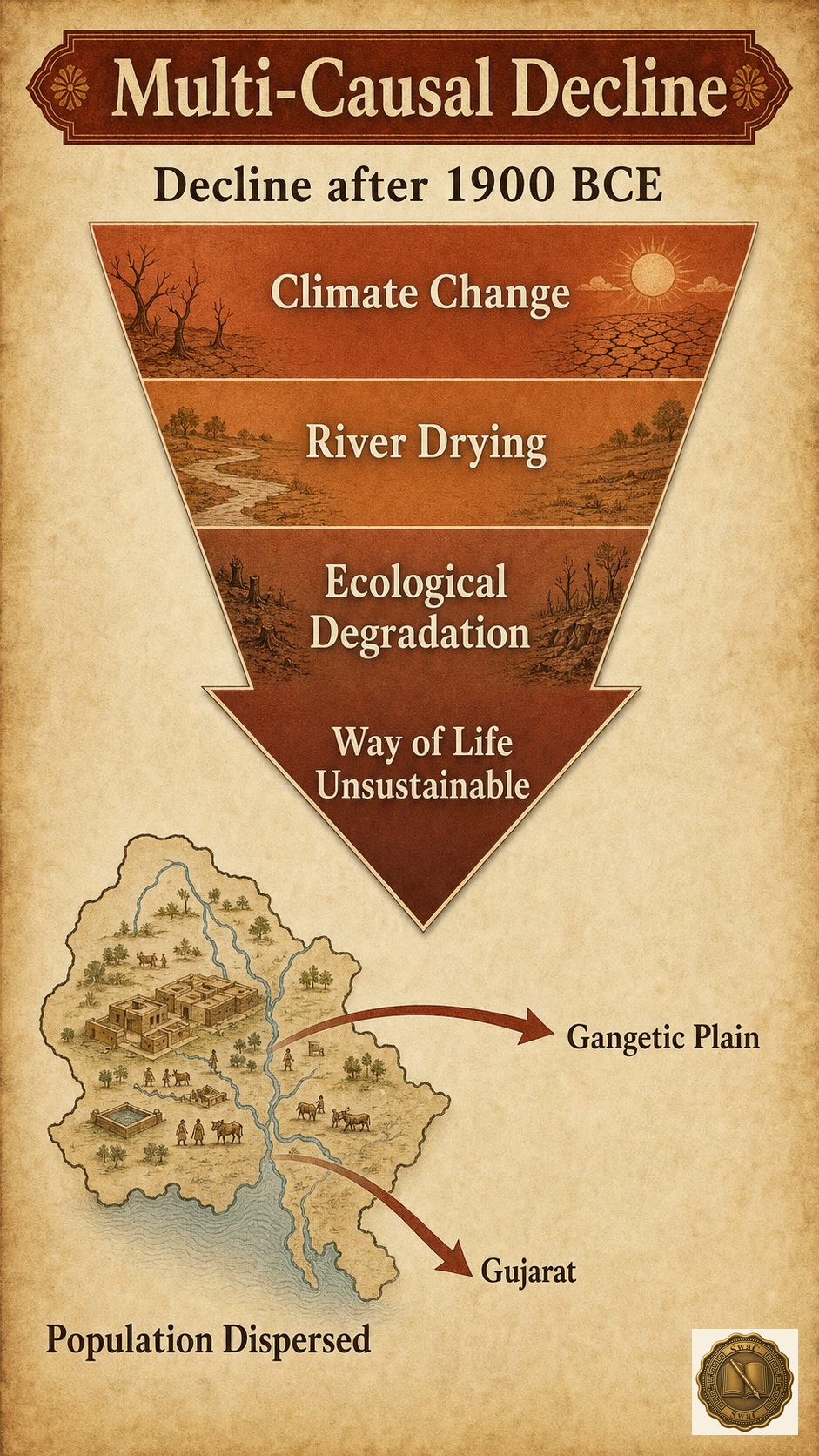
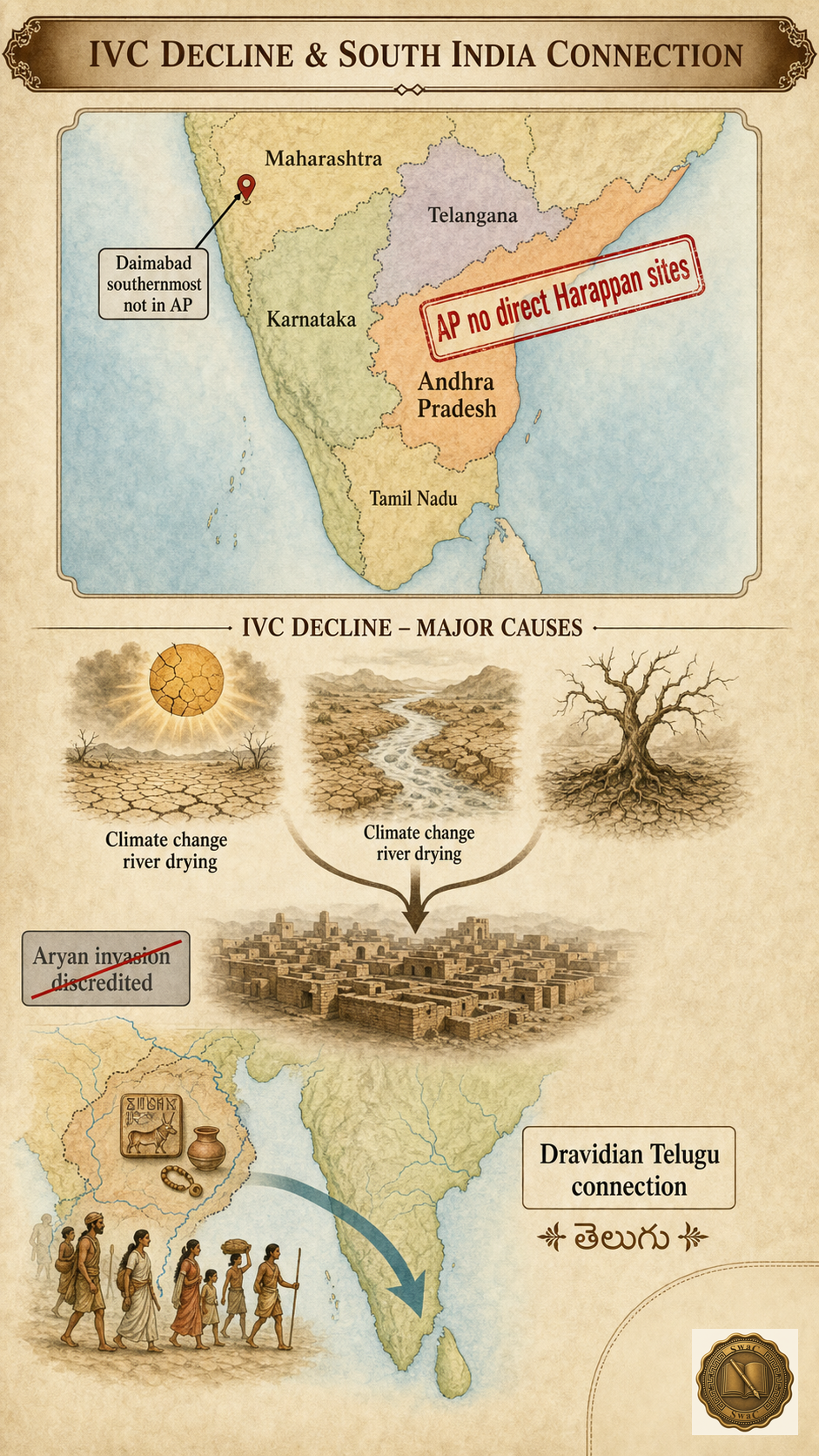
After 1900 BCE, the urban world unravelled: the standard bricks, the writing, the weights, the planned streets — all gradually disappeared as people dispersed into villages. The old story blamed invading Aryans; that theory is now largely discredited, with no evidence of mass warfare. The modern consensus is slower and sadder: weakening monsoons, the drying of the Ghaggar-Hakra river system — confirmed by satellite imagery — and ecological exhaustion made city life impossible. The people did not vanish. They moved on.
Marks-winning facts · recall first
- Population dispersed toward the Gangetic plain, Gujarat, and the south
The theories
Seven suspects, no single killer
Historians have put seven suspects on trial for the death of the Indus cities. Mortimer Wheeler blamed Aryan invaders — now largely discredited, since no battlefield evidence exists and genetics show no sudden population replacement. Geology backs two suspects strongly: the weakening monsoon and the drying of the Ghaggar-Hakra, confirmed by satellite imagery. Marshall and Mackay found flood layers at Mohenjo-Daro; Fairservis argued the cities ate their own forests; recent skeletal studies by Gwen Robbins Schug reveal rising violence and disease in the final decades; and R.L. Raikes proposed earthquakes that re-routed rivers. The verdict of modern scholarship: a slow conspiracy of climate, rivers, and ecology.
Marks-winning facts · recall first
VII
The Legacy
The Andhra connection
Are Telugu speakers the Harappans' heirs?
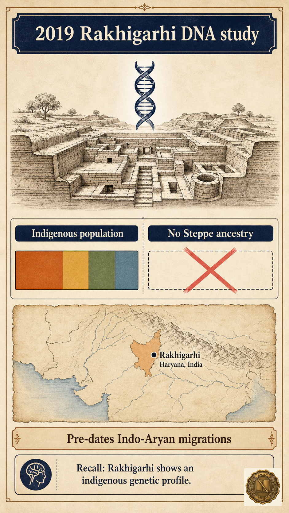
No Harappan site lies inside Andhra Pradesh — but the connection may run deeper than geography. Skeletal studies identify the majority Harappan population as Proto-Australoid and Mediterranean (Dravidian) types, and the 2019 DNA study at Rakhigarhi found no Steppe ancestry — the civilization was indigenous, predating the Indo-Aryan migrations. If Mahadevan and Parpola are right that the Indus script encodes a Dravidian language, then the family that includes Telugu may descend directly from the people who built these cities — and the post-decline migrations toward the Krishna–Godavari valleys carried their world south.
Marks-winning facts · recall first
- Dravidian-language hypothesis links IVC to Telugu's language family
The road south
A bronze chariot points toward the Deccan
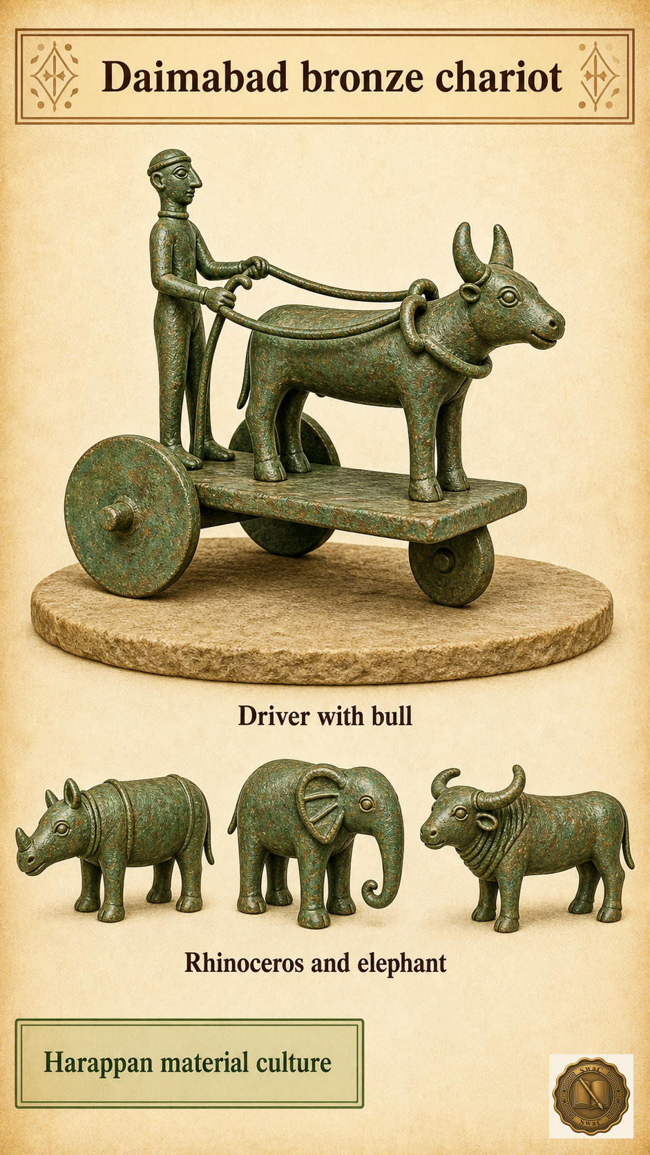
At Daimabad in Maharashtra — the civilization's southernmost outpost — archaeologists found a remarkable bronze set: a charioteer with his bull, joined by a rhinoceros, an elephant and a buffalo. It proves Harappan material culture reached deep into peninsular India, onto the same Deccan formation that runs into Andhra Pradesh. After the decline, scholars trace migration routes through the Deccan toward the Krishna–Godavari valleys. The Megalithic burial culture that later rose in Kurnool, Anantapur and Guntur (1000–300 BCE) may carry that inheritance — though with iron and the horse, two things the Harappans never had.
Marks-winning facts · recall first
The exam armoury
Four absences that win you marks
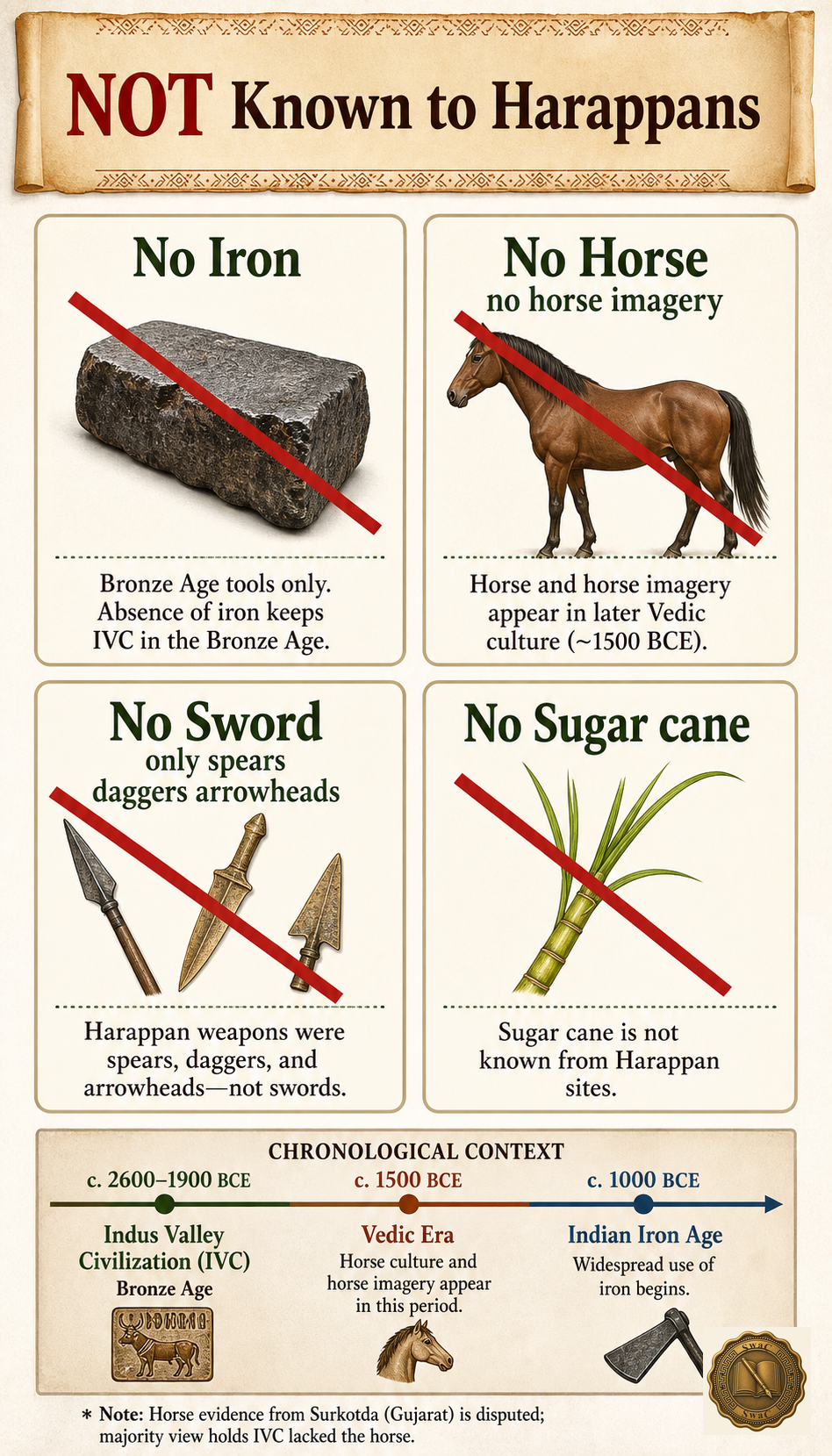
APPSC's favourite trick is asking what the Harappans did NOT have. Memorize the four absences: iron (this was the Bronze Age), the horse (no bones, no seal imagery — the disputed Surkotda claim aside), the sword, and sugar cane. And watch the twin traps: Rakhigarhi is the largest site overall, while Dholavira is the largest in India and a UNESCO World Heritage Site since 2021 — and the southernmost site is Daimabad in Maharashtra, never Andhra Pradesh.
Marks-winning facts · recall first
Exam tactics
Play the percentages, not your luck
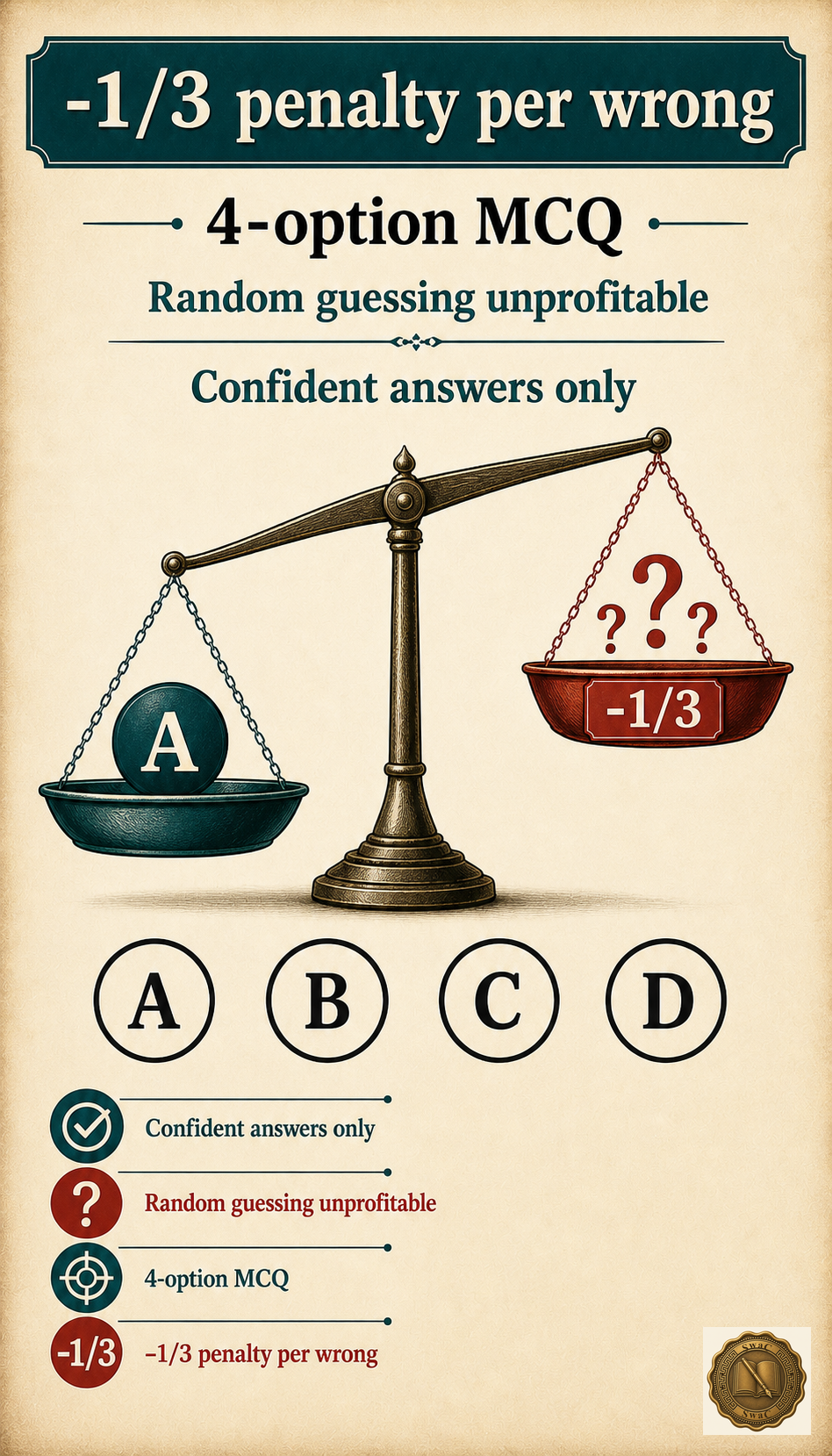
Expect two to three questions from this chapter in the Screening Test. Site-and-discoverer matchings have definite answers — if you know the table, answer with confidence; the risk is low. On 'NOT known' questions, eliminate the three you are sure were known and mark the remainder — but never guess blind, because the −1/3 penalty makes random guessing on a four-option MCQ a losing bet. Budget 45–60 seconds per question; a memorized sites table cuts matching questions to 30.
Marks-winning facts · recall first
End of chapter
Now make it yours
Sites, rivers, discoverers — the single most tested table lives in the full notes. Open it, then test yourself.
Practice MCQs on this chapter →